Desert
Route 66 California Section: Santa Monica to the Arizona Border
Drive the California stretch of Route 66 from Santa Monica Pier to the Colorado River: neon motels, Mojave ghost towns, diners, and where to sleep.

By Alex Khachigian · Updated September 2026 · 4 min read
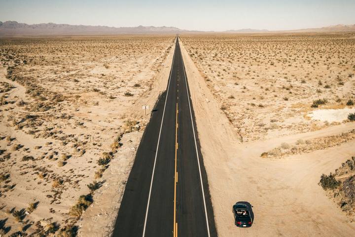
The California section of Route 66 runs about 315 miles from the Santa Monica Pier, through the Los Angeles suburbs and over Cajon Pass, then across the Mojave to the Colorado River.
This guide goes west to east over two days: stops, food, lodging, road closures and desert safety.
In This Guide
Planning the Drive: Distance, Timing, and Road Conditions
Freeways get you from Santa Monica to Arizona in about six hours. The historic alignment adds hours of Los Angeles stoplights and slow desert two-lane.
Plan two days. Day one runs from the coast to Barstow; day two from Barstow to Needles.
Go October to April. Summer highs between Barstow and Needles often top 110 degrees, with long stretches of no services or cell coverage.
Day 1: Santa Monica to Barstow
Day one is mostly city and suburbs, with a few original Route 66 survivors along the way.
Santa Monica to Pasadena: The Urban Start
Photograph the End of the Trail sign on the Santa Monica Pier early, before crowds. The route then follows Santa Monica Boulevard east through West Hollywood and Hollywood.
It continues through downtown to Pasadena on the Arroyo Seco Parkway, one of the West’s first freeways. In South Pasadena, Fair Oaks Pharmacy has run a soda fountain on the route for over a century.
Foothill Boulevard: Monrovia to San Bernardino
East of Pasadena the route becomes Foothill Boulevard. Monrovia has the Aztec Hotel, a 1920s Mayan Revival landmark, and Rancho Cucamonga has the restored Cucamonga Service Station museum.
Fontana has Bono’s Historic Orange, a restored roadside orange stand. The Wigwam Motel in San Bernardino (Rialto mailing address) rents concrete teepees.
Cajon Pass to Victorville and Oro Grande
The route climbs Cajon Pass alongside I-15 and a busy rail line. In Victorville, the volunteer-run California Route 66 Museum on D Street holds signs, photos and memorabilia.
North of Victorville, National Trails Highway follows the Mojave River through Oro Grande and Helendale. Elmer’s Bottle Tree Ranch here is a field of metal poles hung with glass bottles.
It’s private property. Stay on the paths and take nothing.
Barstow: Harvey House and the Railroad
Barstow is the day one overnight. The Harvey House (Casa del Desierto), a restored 1911 railroad hotel, holds the Route 66 Mother Road Museum and the Western America Railroad Museum.
Lodging is mostly chain hotels on Main Street and near the I-15 and I-40 split.
Day 2: Barstow to the Colorado River
East of Barstow, traffic drops off and the towns get smaller.
Newberry Springs and Ludlow
National Trails Highway runs beside I-40 through Newberry Springs, home of the Bagdad Cafe from the 1987 film. Hours are irregular, so call ahead.
Ludlow has a cafe and gas. When open, the road from Ludlow to Amboy is long straightaways and railroad sidings with little traffic.
Amboy and Amboy Crater
Amboy has the Roy’s Motel and Cafe sign. The motel is closed, but the store often sells drinks and souvenirs.
West of town, Amboy Crater is a young cinder cone with a rim trail of about 3 to 4 miles round trip.
Essex, Goffs, and Needles
From Amboy the road runs northeast past Cadiz Summit, Chambless, Essex and Goffs, now mostly ruins. The restored Goffs Schoolhouse and Mojave Desert Heritage and Cultural Association grounds open on some weekends.
If the old road is closed, take I-40 to Needles. Needles, on the Colorado River, is the last California town on the route and has the restored El Garces Harvey House.
Route 66 crossed into Arizona at Topock. The Old Trails Arch Bridge there now carries a pipeline.
Extending the Trip Beyond Route 66
From Barstow or Needles you can reach Joshua Tree and Palm Springs, covered in my Southern California desert loop.
The Mojave is very dark at night away from towns. See my California stargazing guide for moon timing, and the Southern California road trips hub for more routes.
Desert Safety and Leave No Trace
Carry at least a gallon of water per person per day, plus extra for the car. Tell someone your route and download offline maps before leaving Barstow.
Many ruins sit on private land: photograph from the road, obey No Trespassing signs, and take no artifacts. My road trip packing list has a desert checklist.
Frequently Asked Questions
How long does it take to drive Route 66 in California?
The historic alignment from Santa Monica to Arizona takes about 9 to 11 hours of driving. Most people split it over two days with a night in Barstow.
Where does Route 66 end in California?
The ceremonial end is the End of the Trail sign on the Santa Monica Pier. The original western terminus was in downtown Los Angeles.
Is the road through Amboy open?
Sections of National Trails Highway from Ludlow to Amboy and toward Essex have closed at times for bridge and flood repairs. Check San Bernardino County road updates and Caltrans QuickMap, and keep I-40 as a backup.
What is the best time of year to drive Route 66 in California?
October to April. Summer east of Barstow is dangerously hot, so drive early, carry extra water and skip hiking.
Can you sleep in the Wigwam Motel?
Yes. The Wigwam Motel in San Bernardino rents its concrete teepees as rooms. Book ahead for weekends.
Destination guide
My Los Angeles hotel, Airbnb and tour picks