Central Coast
A Weekend in Morro Bay and Cayucos: Hikes, Otters and Eats
Plan a weekend in Morro Bay and Cayucos: Morro Rock, paddling with sea otters, Montaña de Oro hikes, Cayucos pier, whale watching and where to stay.

By Alex Khachigian · Updated September 2026 · 6 min read
Morro Bay and Cayucos sit side by side on Estero Bay, about 15 minutes northwest of San Luis Obispo on Highway 1. Morro Bay is a working harbor with a volcanic rock at its mouth. Cayucos, 10 minutes north, is a one-street beach town with an old wooden pier.
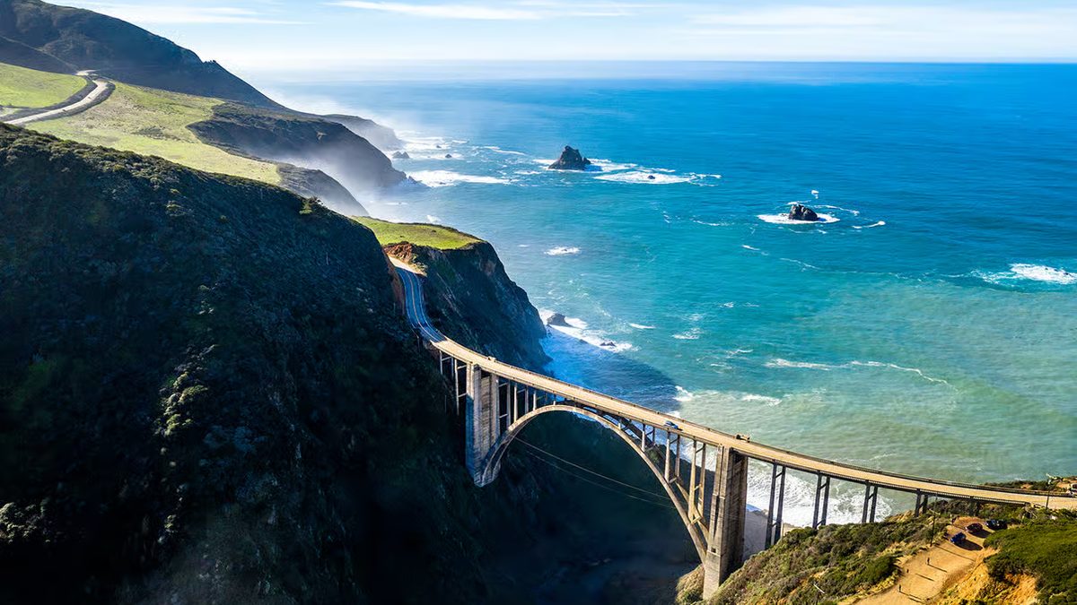
This two-day plan covers paddling, hiking, food, timing and where to stay. It fits into the Pacific Coast Highway road trip between Big Sur and Pismo.
In This Guide
- Best Time to Visit Morro Bay and Cayucos
- Day 1 Morning: Morro Rock and the Embarcadero
- Paddling the Morro Bay Estuary
- Day 1 Afternoon: Hiking Montaña de Oro State Park
- Sunset at Black Hill or Morro Strand
- Day 2: Cayucos Pier, Downtown and Estero Bluffs
- Highway 1 North to Harmony and Cambria
- Whale Watching in Morro Bay
- Where to Stay in Morro Bay and Cayucos
- FAQ
Best Time to Visit Morro Bay and Cayucos
September and October are the clearest, calmest months, with thinner crowds after school starts. Late spring brings green hills and wildflowers in Montaña de Oro.
June through August is often gray until midday, so hike in the afternoon. Winter brings storms, big surf, fewer people and migrating gray whales.
Getting There
Morro Bay is 3.5 to 4 hours from both Los Angeles (via US-101) and San Francisco. From San Luis Obispo it’s 15 minutes north on Highway 1, and Cayucos is 10 minutes further.
San Luis Obispo County Regional Airport (SBP) is about 25 minutes away. You need a car, since trailheads and beaches are spread out.
Day 1 Morning: Morro Rock and the Embarcadero
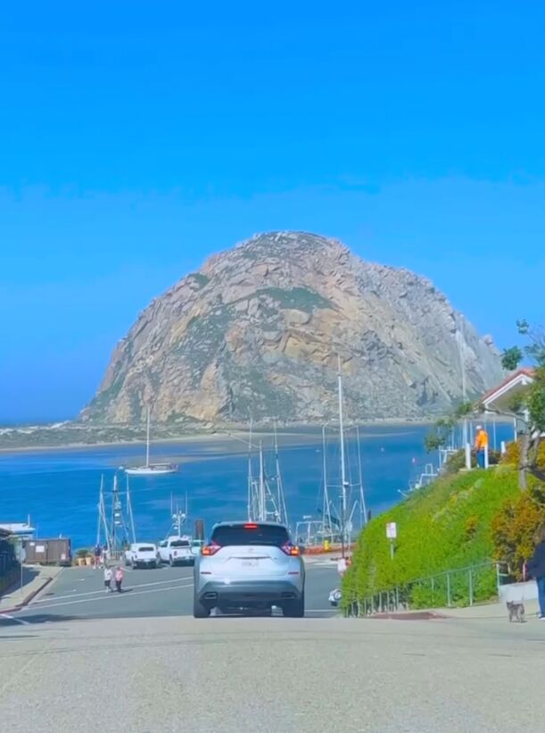
Morro Rock is a 576-foot volcanic plug at the north end of the harbor, the last of the Nine Sisters peaks that run toward San Luis Obispo. Parking at the base is free. Climbing is prohibited because it’s a peregrine falcon nesting site.
Walk the harbor side of the rock to look for sea otters. Then cross to Morro Rock Beach on the north side.
Walking the Embarcadero
The Embarcadero is the flat waterfront street, with fish markets, shops, tour boats and tasting rooms. Otters raft near the docks and sea lions bark from the floats.
Giovanni’s Fish Market serves fish and chips and chowder at outdoor tables. Tognazzini’s Dockside is another seafood spot on the water.
- Morro Rock: free lot at the base, restrooms nearby
- Embarcadero: metered and free lots fill by late morning on weekends
- Morro Bay Museum of Natural History: small state park museum on White Point
Paddling the Morro Bay Estuary
Outfitters on the Embarcadero and near the Morro Bay State Park marina rent kayaks and paddleboards by the hour. The water inside the sand spit is sheltered from swell and suits beginners.
Paddle south along the harbor for otters and harbor seals, or cross to the Morro Bay Sand Spit. The spit is 4 miles of dunes; beach on the bay side and walk over to the ocean beach.
Timing the Tide
At low tide, much of the back bay turns to mudflats and boats run aground. Paddle within a couple of hours of high tide and ask the rental shop which route works that day.
Bird Watching on the Bay
The estuary is a Pacific Flyway stop, with large numbers of shorebirds in winter. A heron rookery near the natural history museum is busiest in spring. Morro Bay holds a bird festival with guided walks each winter.
Day 1 Afternoon: Hiking Montaña de Oro State Park
Montaña de Oro is 25 minutes south of Morro Bay through Los Osos. It has bluffs, coves, a sand spit and wildflower hills in spring. Day use is free.
Drive in on Pecho Valley Road to Spooner’s Cove, a small rocky beach where the main trailheads start.
- Hazard Peak Trail: longer, gentler climb with similar views
- Sand Spit: walk the north end from the Sand Spit day use area off Pecho Valley Road
- Coon Creek Trail: shaded canyon walk at the south end of the park
Bluff Trail
The Bluff Trail runs about 2 flat miles south from Spooner’s Cove past sea caves, arches and pocket beaches. Out and back is 3 to 4 miles. Stay behind the fences, since the cliff edges are undercut.
Valencia Peak Trail
Valencia Peak is about 4.5 miles round trip with roughly 1,200 feet of climbing to a 1,347-foot summit. It starts across the road from Spooner’s Cove and gets steep and loose near the top. The summit looks over Morro Rock, the sand spit and the Nine Sisters.
Go on a clear afternoon, since the top can sit in fog. There’s no shade, so bring extra water.
Sunset at Black Hill or Morro Strand
Black Hill is the peak inside Morro Bay State Park. A 15-minute trail from the upper parking area reaches the top, with views over the bay, Morro Rock and the Nine Sisters.
Morro Strand State Beach is a long, uncrowded beach running north toward Cayucos, with the rock at the south end of the view.
Dinner in Morro Bay
The Embarcadero has seafood restaurants over the harbor. Summer weekend waits are long, so reserve or put your name in before sunset.
Day 2: Cayucos Pier, Downtown and Estero Bluffs
Cayucos centers on Ocean Avenue and a wooden pier from the 1870s, when the town was a shipping landing. People fish from it and watch surfers on either side.
Park near the pier and walk Ocean Avenue: a few blocks of surf shops, antique stores and old storefronts.
Where to Eat in Cayucos
Brown Butter Cookie Company started on Ocean Avenue; the sea salt cookie travels well. Ruddell’s Smokehouse, steps from the beach, is known for smoked fish tacos.
- Brown Butter Cookie Company: original sea salt cookies
- Ruddell’s Smokehouse: smoked fish and fish tacos near the pier
- Schooners Wharf: ocean views for a drink or dinner
Estero Bluffs State Park
Estero Bluffs is undeveloped coastal terrace just north of Cayucos on Highway 1, with informal cliff trails. Dirt pullouts, no fees, few people. Look for tide pools and seals at low tide.
Highway 1 North to Harmony and Cambria
Harmony is about 6 miles north of Cayucos on Highway 1: a tiny hamlet with a small population sign, a glass studio and a few old buildings. A stop takes 20 minutes.
Cambria is 10 to 15 minutes further. Walk the Moonstone Beach Boardwalk, then loop through the Fiscalini Ranch Preserve. Robin’s on Burton Drive is a good dinner stop.
Adding Hearst Castle
Hearst Castle is 15 minutes north of Cambria in San Simeon. Tours take a few hours with the bus ride, so give it its own morning. The Piedras Blancas elephant seal rookery just past it needs 30 minutes.
Whale Watching in Morro Bay
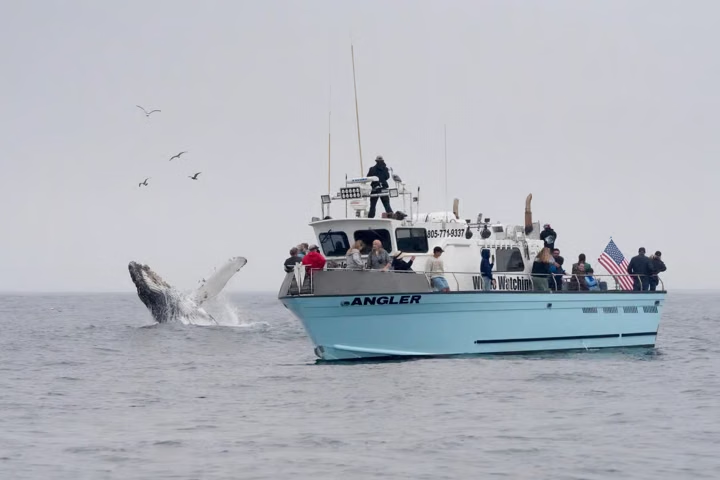
Boats from Morro Bay reach open water quickly. Humpbacks feed offshore roughly spring through fall, and gray whales migrate past in winter and early spring. Dolphins and sea lions show up on most trips.
Operators on the Embarcadero run 2 to 3 hour whale watching trips and short glass bottom boat rides. Book a morning departure, when wind and swell are lower.
Where to Stay in Morro Bay and Cayucos
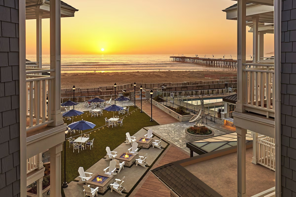
Morro Bay has the most rooms, mostly motels and small hotels on the Embarcadero and Harbor Street. In Cayucos, The Pacific Motel is a simple base near the pier. On Cambria’s Moonstone Beach Drive, White Water is a modern stay facing the ocean and closer to Hearst Castle.
San Luis Obispo is 15 minutes away with more restaurants. See where to stay in San Luis Obispo and Pismo Beach and oceanfront hotels on the Central Coast.
- Camping: Morro Bay State Park, Morro Strand State Beach and Montaña de Oro campgrounds book up months ahead for summer weekends
- Wine side trip: Paso Robles is 35 to 45 minutes inland on Highway 46; see weekend in Paso Robles
Frequently Asked Questions
Is Morro Bay or Cayucos better for a weekend?
They’re 10 minutes apart, so visit both. Morro Bay has more restaurants, rentals and tours; Cayucos is smaller and quieter.
Can you climb Morro Rock?
No. It’s a protected peregrine falcon nesting site. You can walk around the base and park in the free lot beside it.
Where can I see sea otters in Morro Bay?
On the harbor side of Morro Rock and along the Embarcadero docks. If you paddle, stay at least 50 feet away.
How long is the Valencia Peak hike?
About 4.5 miles round trip with roughly 1,200 feet of gain. Most people take 2 to 3 hours.
When is whale watching best in Morro Bay?
Humpbacks are around spring through fall, and gray whales pass in winter and early spring. Tours run year round.
Destination guide
My San Luis Obispo County hotel, Airbnb and tour picks