Sierra Nevada
San Francisco to Lake Tahoe Driving Guide: Best Pitstops along I-80 & US-50
Driving from San Francisco to Lake Tahoe? Compare I-80 and US-50, dodge traffic and chain controls, and find the best pitstops for food, views, and hikes.

By Alex Khachigian · Updated September 2026 · 4 min read
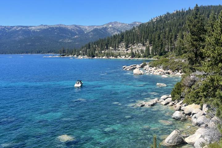
San Francisco to Lake Tahoe is roughly 190 miles, about 3.5 to 4 hours without traffic, via I-80 to Truckee and North Lake Tahoe or US-50 to South Lake Tahoe.
This guide compares the two routes and covers pitstops, Friday traffic and winter chain controls.
In This Guide
I-80 vs. US-50: Which Route Should You Take?
Pick the route that ends closest to where you’re sleeping.
I-80: For North Lake Tahoe and Truckee
Take I-80 for Truckee, Tahoe City, Kings Beach, Northstar, Palisades Tahoe or Incline Village. It’s a four-lane interstate over Donner Summit, faster in good weather, but with heavy trucks and storm closures.
US-50: For South Lake Tahoe
Take US-50 for South Lake Tahoe, Stateline, Meyers, Heavenly or Kirkwood. It’s narrower, following the American River canyon over Echo Summit, with more summer river stops.
My guide to where to stay in Lake Tahoe compares North Lake and South Lake.
Beating Traffic and Winter Chain Controls
Friday and Sunday afternoons are worst, especially in ski season and on summer holidays. Leave San Francisco before 1 p.m. or after 8 p.m. Friday, and return early Sunday or on Monday.
Winter chain controls usually start above Colfax on I-80 and above Kyburz or Pollock Pines on US-50. Carry chains or drive 4WD with snow-rated tires, and check Caltrans QuickMap before and during the drive.
Pitstops Along Each Route
The routes split in Sacramento.
I-80: Auburn to Donner Summit
In Auburn, Ikeda’s California Country Market sells burgers, fruit pies and produce off the freeway. I-80 then climbs through Colfax, Gold Run and Emigrant Gap above the American River canyon.
Near the top, exit at Soda Springs or Donner Summit for Old Highway 40 (Donner Pass Road). The Rainbow Bridge overlooks Donner Lake, and nearby trails lead to old railroad tunnels and petroglyphs.
Donner Memorial State Park at the lake’s east end covers the Donner Party and has a lakeside beach. Downtown Truckee’s Commercial Row is minutes away.
US-50: Placerville to Echo Summit
US-50 heads east through Folsom and El Dorado Hills to Placerville, a Gold Rush town where it crosses Highway 49. See my Gold Country Highway 49 guide for a detour.
In fall, Apple Hill east of Placerville has orchards, cider donuts and pies. October weekends are very crowded; go on a weekday.
Past Pollock Pines the road follows the South Fork of the American River through Kyburz and Strawberry. Stop at historic Strawberry Lodge, or hike the Pyramid Creek Trail near Twin Bridges to Horsetail Falls.
Arriving at Lake Tahoe
From Truckee, Highway 89 goes to Tahoe City and Highway 267 to Kings Beach. On US-50, the Echo Summit overlook drops into Meyers and South Lake Tahoe with a full view of the lake.
Emerald Bay on Highway 89 is 20 minutes from South Lake Tahoe and good at sunset. Emerald Bay State Park and D.L. Bliss are covered in my Lake Tahoe scenic loop.
Plan at least two to three full days at Tahoe. That allows a hike like Monkey Rock (about 2.6 miles, roughly 90 minutes) or a paddle from my kayaking and paddleboarding guide.
Where to Eat and Stay Along the Way
Auburn, Placerville and Truckee are good overnight stops. Truckee has the Truckee Hotel and Cedar House Sport Hotel.
Outside Tahoe City, River Ranch Lodge sits on the Truckee River with a seasonal patio. In South Lake Tahoe, Lake Tahoe Resort Hotel and The Landing Tahoe are near the lake.
Eat at local spots in the bigger towns rather than freeway chains. Skiers can find slope-side lodging in my ski-in, ski-out guide.
Frequently Asked Questions
How long is the drive from San Francisco to Lake Tahoe?
About 190 miles, 3.5 to 4 hours without traffic. Friday afternoons or winter storms can push it past 6 hours.
Is I-80 or US-50 better for driving to Lake Tahoe?
I-80 is better for North Lake Tahoe and Truckee and usually faster. US-50 is better for South Lake Tahoe, with more river and waterfall stops.
Do I need chains to drive to Lake Tahoe in winter?
Possibly. Chain controls apply unless you have 4WD with snow tires, and sometimes even then. Carry chains November to April and check Caltrans QuickMap.
How many days should I spend at Lake Tahoe?
At least two to three full days. That covers Emerald Bay, a couple of beaches and one hike.
Destination guide
My Lake Tahoe hotel, Airbnb and tour picks