Sierra Nevada
Highway 395 Road Trip: 7-Day Eastern Sierra Itinerary
A 7-day Highway 395 road trip from Lone Pine to Bodie: stops, hikes, hot springs, lakes, food and places to sleep, plus winter chain controls and passes.
By Alex Khachigian · Updated September 2026 · 6 min read
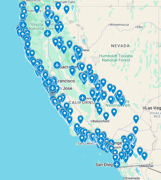
This 7-day Highway 395 itinerary runs south to north along the eastern Sierra, from Lone Pine (3.5 hours from Los Angeles) to Bodie State Historic Park. From the Bay Area, run it in reverse.
It is for late spring to fall. Winter chain controls, closed passes and summits are covered at the end.
In This Guide
- Before You Go: Timing, Roads, and Reservations
- Day 1: Lone Pine and the Alabama Hills
- Day 2: Big Pine, Bristlecones, and Bishop
- Day 3: Bishop Creek Canyon to Convict Lake
- Day 4: Mammoth Lakes Basin and Devils Postpile
- Day 5: Hot Creek and the June Lake Loop
- Day 6: Mono Lake and Tioga Pass
- Day 7: Bodie Ghost Town and Bridgeport
- Driving Highway 395 in Winter
- FAQ
Before You Go: Timing, Roads, and Reservations
Go mid-June to mid-October. Tioga Pass, the bristlecone road, the Mammoth Lakes Basin and the Devils Postpile road close seasonally.
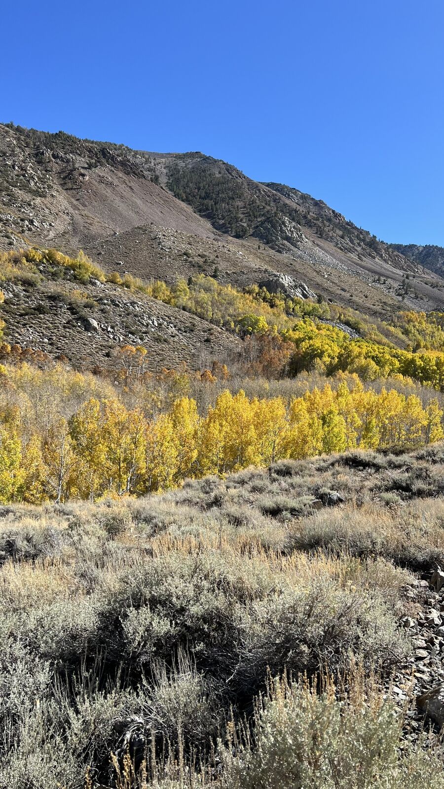
Fall color peaks in late September and early October; see the Eastern Sierra fall foliage guide.
Book summer weekends 3 to 6 months out. Check Caltrans QuickMap, NPS.gov and Inyo National Forest for closures and permits.
Day 1: Lone Pine and the Alabama Hills
Drive 3.5 hours from Los Angeles via Highway 14 and 395.
- Eat: Alabama Hills Cafe
- Sleep: Dow Villa Motel in Lone Pine, or dispersed camping in the Alabama Hills (use existing sites, pack out everything)
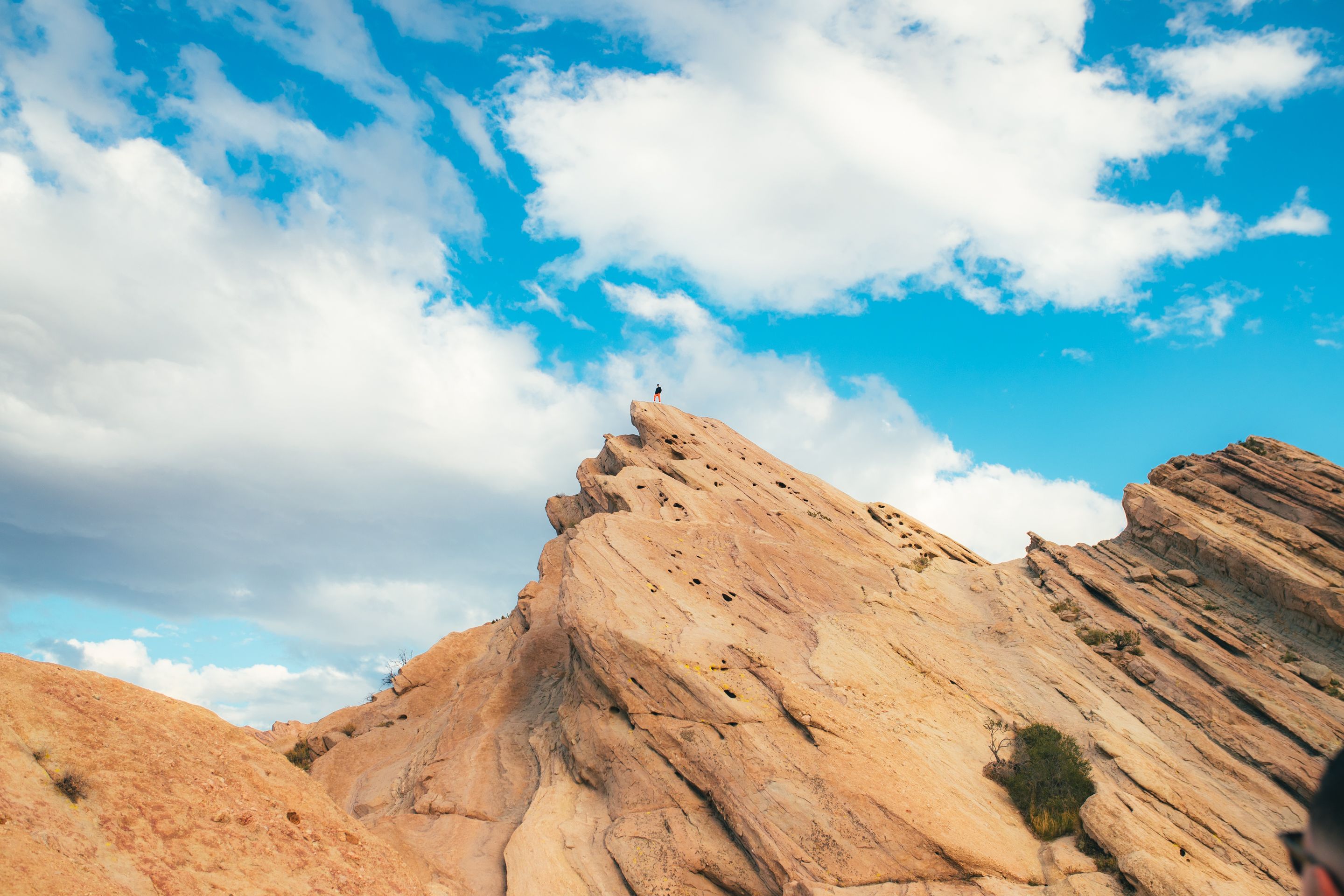
Movie Road and the Arches
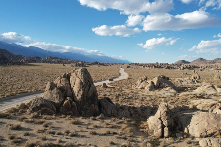
Movie Road’s boulders appear in hundreds of Westerns. A half-mile loop reaches Mobius Arch.
- Mobius Arch, with the Whitney view
- Heart Arch and Lathe Arch, near the Mobius loop
- Boot Arch, Cyclops Arch and the Eye of Alabama Hills
- Iron Man Jericho scenic overlook
Whitney Portal Road
Drive Whitney Portal Road to 8,300 feet; a short walk reaches a waterfall.
Day 2: Big Pine, Bristlecones, and Bishop
Drive 45 minutes to Big Pine early.
Ancient Bristlecone Pine Forest
Take Highway 168 and White Mountain Road to Schulman Grove, about an hour, at 10,000 feet.
Hike the Discovery Trail (1 mile) or Methuselah Trail (4.5 miles). See the bristlecone pine guide.
An Evening in Bishop
Restock in Bishop, the largest town on this stretch.
- Eat: Erick Schat’s Bakkery for sandwiches and sheepherder bread, Mountain Rambler Brewery for dinner
- Sleep: Wayfinder Bishop on Main Street
Day 3: Bishop Creek Canyon to Convict Lake
Lakes, then the Mammoth area.
Bishop Creek Canyon
Highway 168 west leads to Lake Sabrina and South Lake, both near 9,000 feet.
North Lake and Intake Two are nearby. Fall color arrives here first.
Convict Lake
Convict Lake, 45 minutes north, has a flat 2.5-mile loop. Mammoth is 10 minutes away.
- Sleep: Convict Lake Resort cabins, or Mammoth
Day 4: Mammoth Lakes Basin and Devils Postpile
Start early and head uphill.
- Eat: Stellar Brew for coffee, Toomey’s or Distant Brewing for dinner
- Sleep: Tamarack Lodge in the Lakes Basin, or The Westin Monache Resort in the Village
The Lakes Basin
Lake Mary Road passes Twin Lakes, Lake Mary, Lake Mamie, Lake George and Horseshoe Lake. Walk to TJ Lake and Lake Barrett, or hike to Crystal Lake.
See the Mammoth Lakes Basin guide.
Devils Postpile and Rainbow Falls
Devils Postpile National Monument is in the Reds Meadow Valley. The walk to Rainbow Falls is 5 miles round trip.
Day 5: Hot Creek and the June Lake Loop
Two short drives with many stops.
- Eat: June Lake Brewing and the Ohanas 395 food truck next door
- Sleep: Double Eagle Resort and Spa or a cabin in June Lake
Hot Creek Geologic Site
Hot Creek steams through a volcanic gorge south of Mammoth. The overlook trail takes 20 minutes.
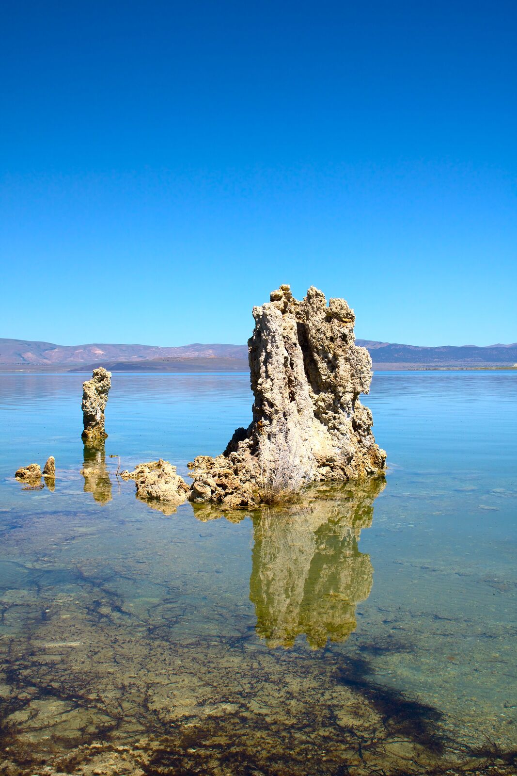
Crowley Lake Stone Columns (Optional)
Access is by dirt road and a shoreline walk; visibility depends on lake level.
The June Lake Loop
The 16-mile June Lake Loop (Highway 158) passes June, Gull, Silver and Grant lakes.
Day 6: Mono Lake and Tioga Pass
The afternoon depends on Tioga being open.
- Eat: Whoa Nellie Deli inside the Mobil station at the 120 and 395 junction
- Sleep: Lake View Lodge in Lee Vining, or June Lake
South Tufa and Lee Vining
Walk South Tufa in the morning, then visit the Mono Lake Committee center in Lee Vining.
Tioga Road Into Yosemite
If open, drive Highway 120 past Tioga Lake, Tuolumne Meadows and Olmsted Point. A park fee applies.
Day 7: Bodie Ghost Town and Bridgeport
Bodie State Historic Park, 45 minutes north of Lee Vining, is a ghost town kept in arrested decay.
The last miles of Highway 270 are unpaved and close with snow. Afterward, soak at Travertine Hot Springs near Bridgeport, or continue 2 hours to the Lake Tahoe scenic loop.
Driving Highway 395 in Winter
Caltrans keeps US 395 open year-round and plows around the clock. Expect chain controls, plow traffic and short closures during and after storms.
Lone Pine, Bishop and Mammoth Lakes have year-round lodging, food and gas. June Lake stays open; Lee Vining and Bridgeport mostly close until spring.
Sierra Passes That Close in Winter
From the Bay Area or Central Valley, reach 395 via Highway 14 or 58 in the south, or I-80 to Reno or US 50 to South Lake Tahoe in the north. If a map app routes you over a closed pass in January, it’s wrong.
- Tioga Pass (Highway 120): closes in November, often reopens late May or June
- Sonora Pass (Highway 108): closed about November to late May
- Monitor Pass (Highway 89) and Ebbetts Pass (Highway 4): closed seasonally
- June Lake Loop (Highway 158): north end past Grant Lake closes; the south end to June Lake village stays open
- Open year-round with frequent chain controls: I-80 (Donner Summit), US 50 (Echo Summit), Highway 88 (Carson Pass)
How California Chain Controls Work
Caltrans posts three levels on signs and QuickMap, and checkpoints turn back noncompliant drivers. You must carry chains in chain control areas, even in 4WD or AWD.
- R1: chains or snow tires (6/32 inch tread minimum, M+S or snowflake marking)
- R2: chains on all vehicles except 4WD or AWD with snow tires on all four wheels
- R3: chains on all vehicles, no exceptions; rare, usually just before a closure
Highway 395 Summits to Watch
South of Bishop, 395 rarely sees chain controls, but strong winds affect high-profile vehicles. Deadman Summit (about 8,000 feet) is often the first to get chain controls, and Conway Summit (8,143 feet) is the highest point on 395.
- Sherwin Grade and Sherwin Summit: Bishop to Tom’s Place, long and steep
- Deadman Summit: Mammoth Lakes to June Lake Junction
- Conway Summit: Lee Vining to Bridgeport, highest and most exposed
- Devil’s Gate Summit and Walker Canyon: Bridgeport to the Nevada line
Winter Car Kit and Driving Tips
Keep the tank above half and carry chains, gloves, a headlamp, a snow brush, a shovel, warm layers, water and snacks. Closures behind crashes can hold you for hours.
Black ice forms in shade and on bridges in the morning and evening. Never pass a plow on the right, and drive the high sections between about 10 am and 3 pm.
Frequently Asked Questions
How many days do you need for Highway 395?
Allow 5 to 7 days. The drive itself takes one.
When is the best time to drive Highway 395?
Mid-June to mid-October, when high roads are open. Early October adds fall color.
Is Highway 395 open in winter?
Yes, with storm chain controls. Tioga Pass, the bristlecone road, Lakes Basin roads and Devils Postpile close for the season.
Do I need chains to drive Highway 395 in winter?
You must carry them when chain controls may be in effect, which covers most high sections north of Bishop. 4WD and AWD with snow tires can pass R1 and R2 without installing them.
What is the highest point on Highway 395?
Conway Summit, between Lee Vining and Bridgeport, at 8,143 feet. It often has chain controls.
Should I drive Highway 395 north or south?
From Southern California, go north from Lone Pine. From the Bay Area, go south from Bridgeport.
Destination guide
My Mammoth hotel, Airbnb and tour picks