Desert
Best Slot Canyons in California: Borrego to Death Valley
California’s best slot canyon hikes, from The Slot and Ladder Canyon to Mosaic and Sidewinder in Death Valley, with road access, season and flood safety.

By Alex Khachigian · Updated September 2026 · 3 min read
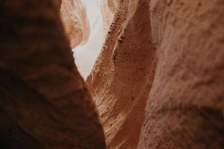
California’s deserts have slot canyons in siltstone, sandstone and marble, most reachable on hikes of an hour or two.
This guide covers slots in Anza-Borrego, the Mecca Hills, Death Valley and the Mojave, with road access, difficulty and flood and heat safety.
In This Guide
The Slot in Anza-Borrego Desert State Park
The Slot is Anza-Borrego’s most popular narrows, off Buttes Pass Road from Borrego Salton Seaway (S22). Most cars with decent clearance can reach it when dry.
A short, steep descent drops into a siltstone canyon a few hundred yards long. Most people loop back on the dirt road for about 2 miles total.
Timing and Tips for The Slot
Go early, before the canyon heats up. Borrego Springs, 20 minutes away, has services; my Southern California desert loop links it with Palm Springs.
More Anza-Borrego Slot Canyons
Palm Wash and the Calcite Mine area off S22 have deep slots. The Wind Caves trail near Split Mountain climbs to sandstone formations above Fish Creek.
Sandstone Canyon is reached by 4x4 through Fish Creek Wash. Ask at the visitor center about road conditions; my desert 4x4 guide covers the drives.
Ladder Canyon and Painted Canyon in the Mecca Hills
Ladder Canyon, in the Mecca Hills Wilderness, climbs a slot by metal ladders, follows a ridge and returns through Painted Canyon.
Access is via Painted Canyon Road off Box Canyon Road, usually fine with high clearance when dry. It’s a half-day trip from a Palm Springs weekend.
- Distance: 4 to 5 mile loop
- Difficulty: moderate, ladders and scrambling
- Best season: November to March
- Services: Mecca and Indio
Death Valley Slot Canyons
Death Valley has marble narrows and dark side slots. Pair one with my Death Valley winter itinerary.
Mosaic Canyon
Mosaic Canyon, outside Stovepipe Wells, has polished marble narrows. Most people hike 1 to 2 miles in to a dry fall.
Sidewinder Canyon
Sidewinder Canyon, off Badwater Road, has dark, unsigned side slots, so bring a GPS track. It made my Death Valley list.
Fall Canyon, Titus Narrows and Marble Canyon
Lower Titus Canyon and Fall Canyon start from the parking area at the Titus mouth. Marble Canyon needs a high-clearance vehicle.
Mojave Slot Canyons: Banshee and Afton Canyon
In the Mojave National Preserve, the Rings Loop Trail at Hole-in-the-Wall passes through Banshee Canyon, with metal rings bolted into the rock to climb out.
Afton Canyon, a BLM area off Interstate 15, has side slots, and the Mojave River runs above ground there.
Flash Flood and Heat Safety in Slot Canyons
Slot canyons can flood in minutes from rain miles away. Check the forecast for the whole watershed and never enter if thunderstorms are possible.
Late summer monsoon season brings the highest flood risk and extreme heat. Hike November to March, start early and tell someone your plan.
- Check NWS forecasts and park alerts before every hike
- Carry 2 to 3 liters of water per person
- Wear shoes with good grip
- Don’t carve, mark or chalk the walls
Frequently Asked Questions
Are there slot canyons in California?
Yes. The best known are The Slot in Anza-Borrego, Ladder Canyon in the Mecca Hills, and Mosaic and Sidewinder canyons in Death Valley.
What is the easiest slot canyon hike in California?
The Slot in Anza-Borrego suits most hikers, including families. The first mile of Mosaic Canyon is also easy.
When is the best time to hike slot canyons in California?
November to March. Avoid late summer, when monsoon storms bring flash floods and extreme heat.
Do you need a 4x4 to reach California slot canyons?
Not always. The Slot and Mosaic Canyon are reachable in most cars with decent clearance when dry; Sandstone Canyon and Marble Canyon need high clearance or 4WD.
Are the Ladder Canyon ladders safe?
Usually, but volunteers maintain them informally. Inspect each ladder and skip the hike if they look damaged.