Northern California
How to Visit Mt. Shasta: Lakes, Waterfalls and Scenic Drives
Plan a Mt. Shasta trip: the Everitt Memorial Highway, Panther Meadows, Castle Lake and Heart Lake, McCloud Falls, Castle Crags, climbing permits and stays.

By Alex Khachigian · Updated September 2026 · 4 min read

Mt. Shasta is a 14,179-foot volcano in far Northern California, visible from more than 100 miles away. The town at its base serves climbers, anglers, skiers and spiritual visitors.
Most sights here are within 45 minutes of town. For a loop that adds Lassen, see the Shasta-Cascade driving route.
In This Guide
Getting to Mt. Shasta
Mt. Shasta is off I-5, an hour north of Redding, 3.5 hours from Sacramento and 4.5 hours from San Francisco. Redding has the closest airport; Sacramento and Medford, Oregon, have more flights.
Driving the Everitt Memorial Highway
The Everitt Memorial Highway climbs the south side of the mountain. Bunny Flat, at about 6,950 feet, is the main trailhead and is usually plowed in winter.
In summer and early fall the road continues to Panther Meadows and the Old Ski Bowl at about 7,800 feet, the highest drivable point.
When the Upper Road Opens
The road above Bunny Flat usually opens in late June or July and closes with the first big fall storms. Check with the Mt. Shasta Ranger Station or the Shasta-Trinity National Forest site.
Panther Meadows and the Spiritual Side of Mt. Shasta
Mt. Shasta is sacred to regional tribes, including the Winnemem Wintu, and has drawn spiritual seekers for over a century. The town has crystal shops and meditation centers.
Panther Meadows is a spring-fed subalpine meadow near the top of the road and a sacred tribal site. Stay on the path, build no rock stacks, leave no offerings and keep quiet.
Best Alpine Lakes Near Mt. Shasta
Lake Siskiyou, just outside town, reflects the mountain and has a beach and boat rentals.
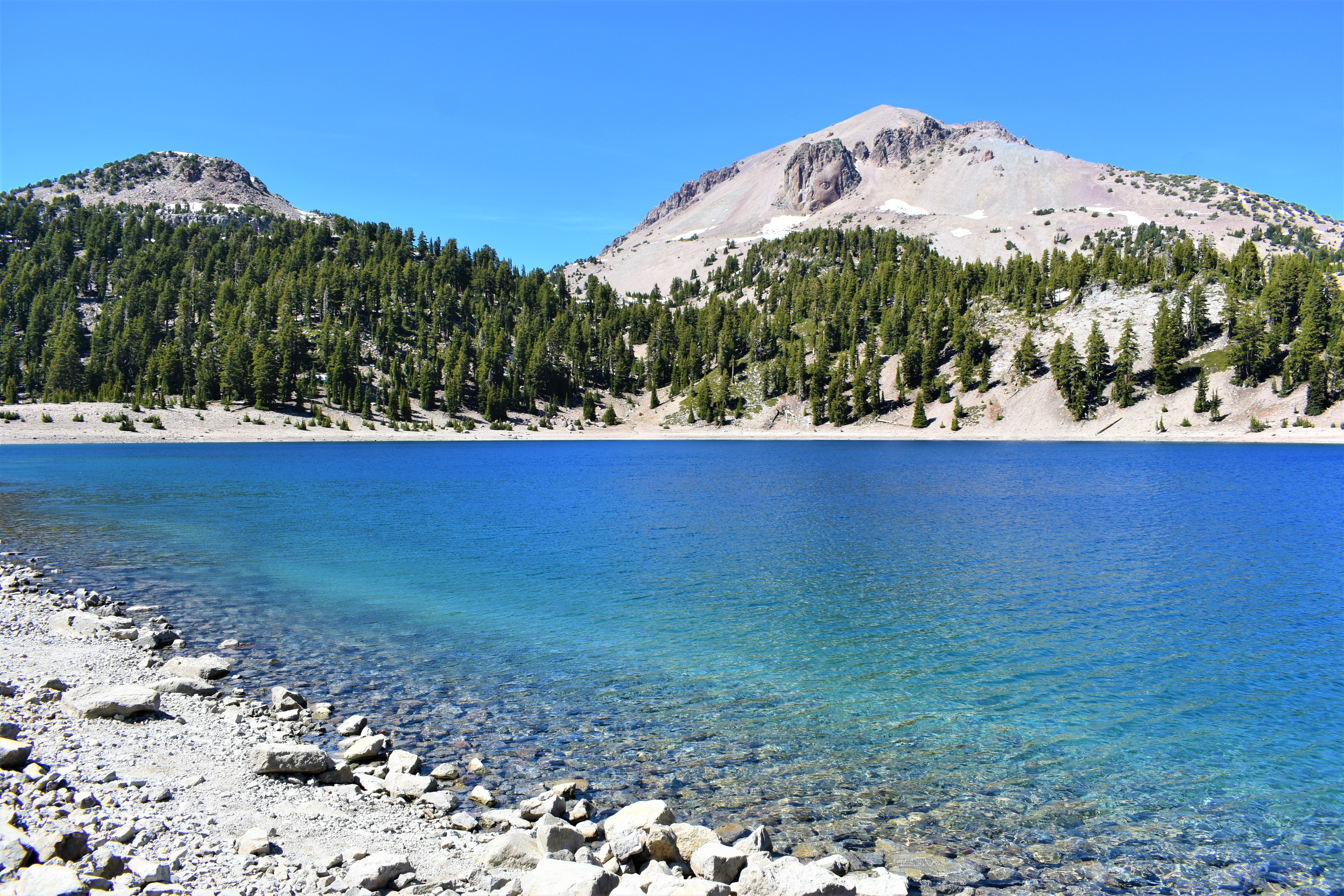
Castle Lake, 25 minutes from town, is a colder glacial lake below granite cliffs.
Heart Lake Hike
From the Castle Lake parking area, a steep trail of about a mile each way climbs to Heart Lake, a small tarn with Mt. Shasta behind it. Go early on summer weekends.
In town, Mt. Shasta City Park has the spring-fed headwaters of the Sacramento River.
Waterfalls Near Mt. Shasta and Castle Crags State Park
McCloud River Falls, east of town, is three waterfalls (Lower, Middle, Upper) on a trail about 3.8 miles round trip. Middle Falls is the largest.
Hedge Creek Falls in Dunsmuir is a short walk, and the trail goes behind the falls.
Castle Crags and Burney Falls
Castle Crags State Park, 15 minutes south, has granite spires above I-5. The Crags Trail to Castle Dome is strenuous; the Vista Point is a short walk from the upper lot.
McArthur-Burney Falls Memorial State Park is a little over an hour east. See the Northern California waterfalls guide.
Climbing Mt. Shasta: Routes and Permits
Avalanche Gulch, the most popular route, gains over 7,000 feet from Bunny Flat and usually needs an ice axe, crampons and snow experience.
Most climbers take two days and camp at Helen Lake, around 10,400 feet. Early summer, while the route is snow-covered, is the usual season.
Mt. Shasta Summit Pass and Wilderness Permit
Above 10,000 feet you need a Summit Pass (fee) and a free wilderness permit. Get both from the Mt. Shasta Ranger Station or online; the wilderness permit can be self-issued at trailheads.
Where to Stay and Eat Near Mt. Shasta
Mt. Shasta, McCloud and Dunsmuir have historic inns, B&Bs, motels and lakeside camping. See the car camping guide for tent and van options.
Seven Suns Coffee does breakfast in town. Mount Shasta Brewing Company is in Weed, 10 minutes north.
- McCloud Hotel: 1916 hotel in the old lumber town of McCloud
- Mount Shasta Resort: golf resort with chalets near Lake Siskiyou
- Best Western Plus Tree House: in town, indoor pool
- Cold Creek Inn: simple motel near downtown
- Lake Siskiyou Camp Resort: campsites and cabins on the lake
Frequently Asked Questions
Can you drive up Mt. Shasta?
Partway. The Everitt Memorial Highway reaches Bunny Flat year-round and the Old Ski Bowl, about 7,800 feet, in summer.
When is the best time to visit Mt. Shasta?
July through early October for hiking, lakes and the upper road. Winter is for snow sports; carry chains.
Do you need a permit to climb Mt. Shasta?
Yes. Above 10,000 feet you need a Summit Pass (fee) and a free wilderness permit from the Mt. Shasta Ranger Station or online.
What are the vortexes at Mt. Shasta?
Some visitors believe the mountain has spiritual energy centers, especially around Panther Meadows. It is a sacred tribal site, so stay on the trail.
How far is Mt. Shasta from Burney Falls?
A little over an hour via Highway 89 through McCloud, passing McCloud Falls.