Sierra Nevada
Driving Highway 395 in Winter: Chains, Passes and Roads
How to drive Highway 395 in winter: chain control levels, the summits to watch, which Sierra passes close, where to get gas and how to check conditions.

By Alex Khachigian · Updated September 2026 · 4 min read
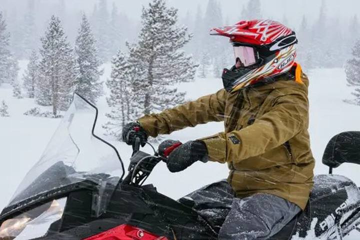
Highway 395 climbs above 8,000 feet north of Mammoth, with chain controls and occasional storm closures in winter.
This guide covers chain controls, problem summits, seasonal pass closures, car prep and condition checks. Rules change with every storm, so check Caltrans before each leg.
In This Guide
Is Highway 395 Open in Winter?
Yes. Caltrans keeps US 395 open year-round and plows around the clock. Expect chain controls, plow traffic and short closures during and after storms.
Several passes that cross the Sierra to 395 close from about November to late spring. If a map app routes you over one in January, it’s wrong.
Sierra Passes That Close in Winter
From the Bay Area or Central Valley, reach 395 via Highway 14 or 58 in the south, or I-80 to Reno or US 50 to South Lake Tahoe in the north.
- Tioga Pass (Highway 120): closes in November, often reopens late May or June
- Sonora Pass (Highway 108): closed about November to late May
- Monitor Pass (Highway 89) and Ebbetts Pass (Highway 4): closed seasonally
- June Lake Loop (Highway 158): north end past Grant Lake closes; south end to June Lake village and June Mountain stays open
- Highway 203 past Mammoth Mountain Main Lodge to Minaret Vista and Reds Meadow: closed to cars
- Open year-round with frequent chain controls: I-80 (Donner Summit), US 50 (Echo Summit), Highway 88 (Carson Pass)
How California Chain Controls Work
Caltrans posts three chain control levels on signs and QuickMap. Checkpoints turn back noncompliant drivers. You must carry chains in chain control areas, even in 4WD or AWD.
- R1: chains or snow tires (6/32 inch tread minimum, M+S or snowflake marking)
- R2: chains on all vehicles except 4WD or AWD with snow tires on all four wheels
- R3: chains on all vehicles, no exceptions; rare, usually just before a closure
Highway 395 Summits to Watch
South of Bishop, 395 rarely sees chain controls, but strong winds affect high-profile vehicles. North of Bishop the road climbs thousands of feet in a few miles.
Deadman Summit (about 8,000 feet) is often the first to get chain controls. Conway Summit (8,143 feet) is the highest point on 395.
- Sherwin Grade and Sherwin Summit: Bishop to Tom’s Place, long and steep
- Deadman Summit: Mammoth Lakes to June Lake Junction
- Conway Summit: Lee Vining to Bridgeport, highest and most exposed
- Devil’s Gate Summit and Walker Canyon: Bridgeport to the Nevada line
How to Prepare Your Car for Winter on 395
Pack for a few unplanned hours in the car, since closures behind crashes are common. Keep the tank above half and carry freeze-rated washer fluid. My road trip packing list has the full winter kit.
- Correctly sized chains, gloves, kneeling pad, headlamp
- Snow brush, ice scraper, folding shovel
- Warm layers, blanket, water, snacks
- Phone charger and offline maps
Checking Highway 395 Road Conditions
Caltrans QuickMap (web or app) shows chain controls, closures, CHP incidents and cameras. Caltrans road information: 1-800-427-7623, then enter the highway number.
The National Weather Service office in Reno covers Mono County. If a big storm is forecast, wait a day and drive behind it.
Winter Driving Tips for the Eastern Sierra
Drive slowly, leave long gaps and brake before curves. Black ice forms in shade and on bridges in the morning and evening.
Never pass a plow on the right. Drive the high sections between about 10 am and 3 pm, and watch for mule deer at dawn and dusk between Bishop and Lee Vining.
Where to Stop and Stay in Winter
Lone Pine, Bishop and Mammoth Lakes have year-round lodging, food and gas. Lone Pine works as a first night from LA, and Erick Schat’s Bakkery in Bishop is the standard snack stop.
June Lake stays open in winter; Lee Vining and Bridgeport mostly close until spring. See my Death Valley and Eastern Sierra winter itinerary and Mammoth ski guide.
Frequently Asked Questions
Do I need chains to drive Highway 395 in winter?
You must carry them when chain controls may be in effect, which covers most high sections north of Bishop. 4WD and AWD with snow tires can pass R1 and R2 without installing them.
Is Tioga Pass open in winter?
No. It usually closes in November and reopens in late May or June. Use I-80, US 50, or Highway 14 or 58 instead.
What is the highest point on Highway 395?
Conway Summit, between Lee Vining and Bridgeport, at 8,143 feet. It often has chain controls.
How long does it take to drive from LA to Mammoth in winter?
About 5 to 6 hours in good conditions. Plan for 7 or more on ski season Fridays or in storms.
What is the Caltrans road conditions phone number?
1-800-427-7623, then enter the highway number. QuickMap shows the same information with cameras.
Destination guide
My Mammoth hotel, Airbnb and tour picks